Skip to content
Ecophylla Consulting
Projects
AMDS
AMDS QS
AMDS SC
AMDS Photos
BB
BB-99-113
CD
CD – Road Effect Mitigation
CLE
DQ
DQ Turtles 2023
EPC
Upload
PB
221495
HAB
EPC Habitat Mapping in GB
Hwy 559
Killbear
Mata
Mata Photos
MB
216234 RW-JN-CC
216234 RW-GBLT
Misc
PB
PI
NDS
DS RW-AB
Squamata
EFS Photos
Transmitter Implantation
WW
Toggle website search
Menu
Close
Projects
AMDS
AMDS QS
AMDS SC
AMDS Photos
BB
BB-99-113
CD
CD – Road Effect Mitigation
CLE
DQ
DQ Turtles 2023
EPC
Upload
PB
221495
HAB
EPC Habitat Mapping in GB
Hwy 559
Killbear
Mata
Mata Photos
MB
216234 RW-JN-CC
216234 RW-GBLT
Misc
PB
PI
NDS
DS RW-AB
Squamata
EFS Photos
Transmitter Implantation
WW
Toggle website search
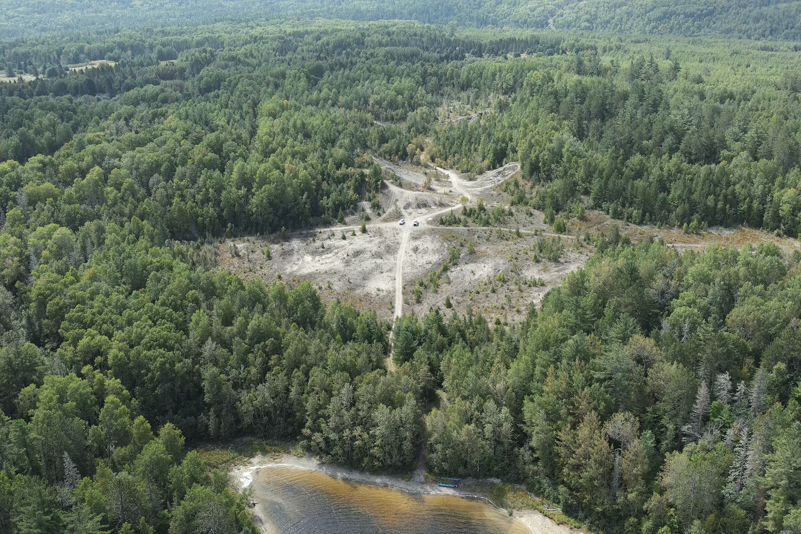
Matabitchuan Terrestrial Assessment
Drone Resources to share
Interactive 3D Map (Point Cloud)
Bell Hickey Farm Area
LiDAR and Photo Derived Point Clouds
Link to Open Full Screen in Separate Tab/Window – Recommended Way to View (especially for small screens)
LiDAR-derived laz file download
lidar-point-cloud_2024-08-28_mata-sand-barren_r2a-sensor_nad83orig.laz
Photo-derived laz file download
photo-point-cloud_2024-08-28_mata-sand-barren_dji-p1_nad83orig.laz
Interactive 2D Map
High Resolution August 2024 Orthoimagery and Oblique Photo Locations and Thumbnails to Download Photos
Open Map Full Screen in New Window
Orthoimage download
ortho_2024-08-28_mata-sand-barren_1pt5-gsd_3cm-hacc_dji-p1-terra_cog_nad83orig.tif
Digital Terrain Model (DTM) generated from LiDAR File download:
DTM_2024-08-28_mata-sand-barren_from-lidar-point-cloud_r2a-sensor_cog_nad83orig.tif
Sample Photo of Site (from river edge, August 28, 2024)
see 2D maps for Photo Viewing and to Download Individual Files
Pileated Woodpecker Tree Photos
Short Video of Site from River Edge to Area Where Aggregate Material was Deposited in the Past
Your browser does not support the video tag.