Skip to content
Ecophylla Consulting
Projects
AMDS
AMDS QS
AMDS SC
AMDS Photos
BB
BB-99-113
CD
CD – Road Effect Mitigation
CLE
DQ
DQ Turtles 2023
EPC
Upload
PB
221495
HAB
EPC Habitat Mapping in GB
Hwy 559
Killbear
Mata
Mata Photos
MB
216234 RW-JN-CC
216234 RW-GBLT
Misc
PB
PI
NDS
DS RW-AB
Squamata
EFS Photos
Transmitter Implantation
WW
Toggle website search
Menu
Close
Projects
AMDS
AMDS QS
AMDS SC
AMDS Photos
BB
BB-99-113
CD
CD – Road Effect Mitigation
CLE
DQ
DQ Turtles 2023
EPC
Upload
PB
221495
HAB
EPC Habitat Mapping in GB
Hwy 559
Killbear
Mata
Mata Photos
MB
216234 RW-JN-CC
216234 RW-GBLT
Misc
PB
PI
NDS
DS RW-AB
Squamata
EFS Photos
Transmitter Implantation
WW
Toggle website search
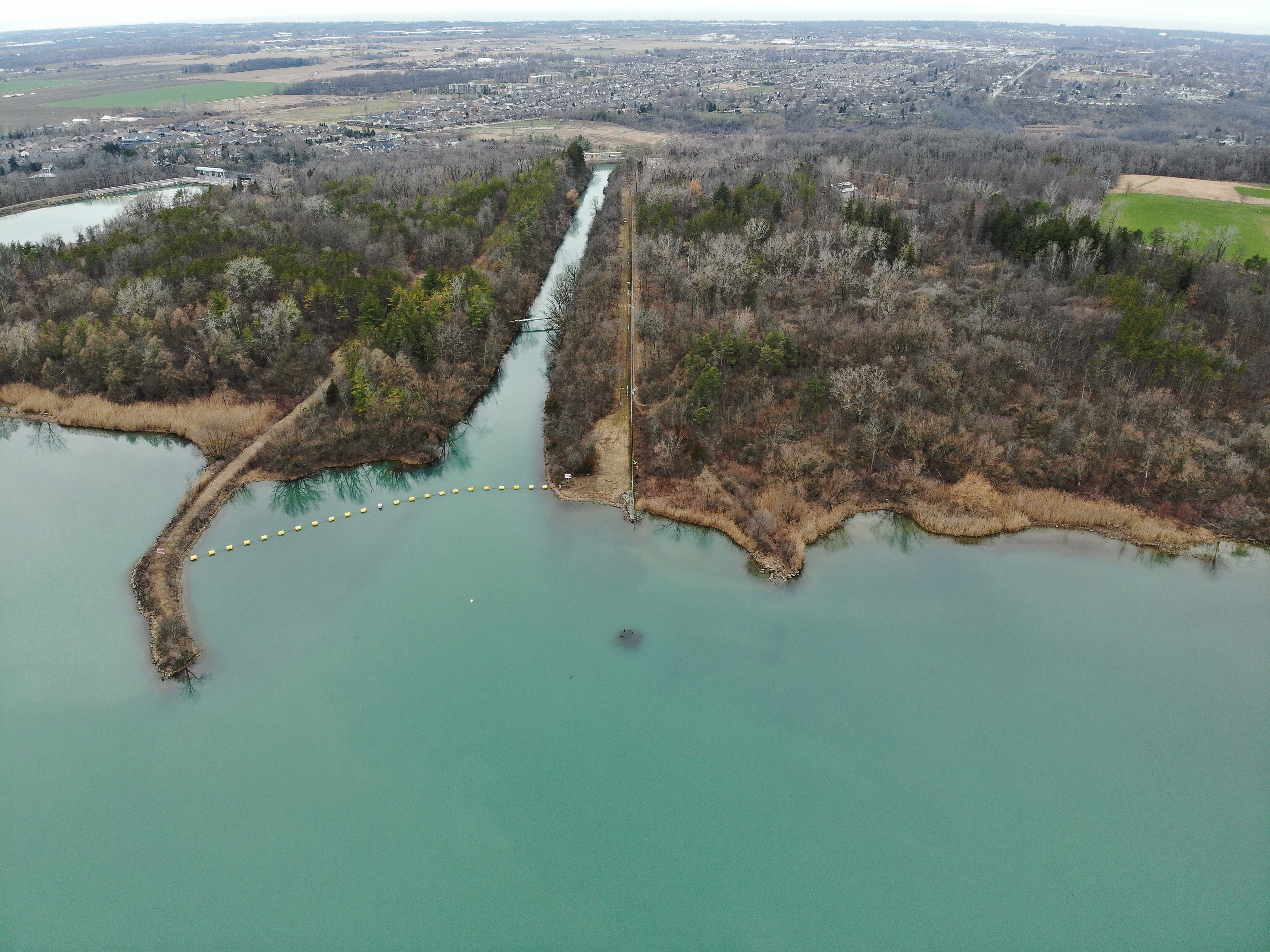
Mitigation Options for Turtles at Lake Moodie
Additional Content
Interactive 3D Map
Lake Moodie (Photo Derived from March 2024 Drone Flight) Point Cloud
Twelve Mile Creek (LiDAR) Point Cloud
Link to Open Full Screen in Separate Tab/Window – Recommended Way to View (especially for small screens)
laz file download
point-cloud_2024-03-14_lake-moodie_from_photos_dji-p1-nad83orig-classified.laz
Interactive 2D Map
High Resolution March 2024 Orthoimagery and Maximum Water Level Shown with Digital Elevation Model
Open Map Full Screen in New Window
Orthoimage download
ortho_2024-03-14_moodie-lake_1pt5-gsd_3cm-hacc_dji-p1-terra_cog_nad83orig.tif
View of Sites A and B (March 15, 2024)